AustraliaCarnarvon
Carnarvon
Administrative Region:
Western Australia
population:
4 559
calling code:
+61-8
postcode:
WA 6701
Location on the map of Australia
Carnarvon
Bakery
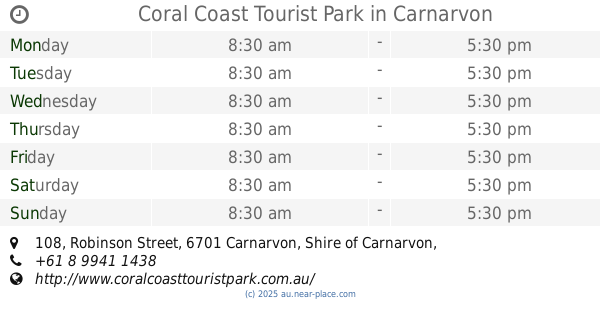
Campground

Furniture store

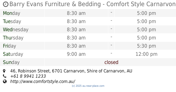
Barry Evans Furniture & Bedding - Comfort Style Carnarvon
46 Robinson Street, Carnarvon
Beauty salon
Car repair


Vince's Motor Line MRB6500 ( Mobile Service Available)
337 Robinson Street, Carnarvon


📑 Carnarvon all categories
AccountingAirportAtmBakeryBankBarBeauty salonBus stationCafeCampgroundCar dealerCar rentalCar repairChurchClothing storeConvenience storeDentistDoctorElectronics storeFire stationFloristFoodFuneral homeFurniture storeGas stationGeneral contractorGrocery or supermarketGymHardware storeHealthHome goods storeHospitalInsurance agencyLaundryLibraryLiquor storeLocal government officeLocalityLodgingMeal deliveryMeal takeawayMoving companyMuseumNatural featurePainterParkPharmacyPlace of worshipPlumberPoint of interestPolicePost officePremiseReal estate agencyRestaurantRouteRv park, campingSchoolShopping mallStorageStoreSupermarketTravel agencyVeterinary care