places in Newcastle
Australia
Newcastle
Newcastle
Administrative Region:
New South Wales
population:
308 308
calling code:
+61-2
postcode:
NSW 2300
Location on the map of Australia
Newcastle
Administrative area level 2
Newcastle City Council
Australia
Administrative area level 2
read more
Lake Macquarie City Council
Australia
Administrative area level 2
read more
Museum
Newcastle Medical Museum
92 Elder Street, Lambton
Museum
read more
The High Castle
18 City Road, Adamstown Heights
Museum
read more
Lost Picnic Area
10 Charlestown Road, New Lambton Heights
Museum
read more
The Creator Incubator
Clyde Street, Hamilton North
Museum
read more
The Big Headphones
114 Darby Street, Cooks Hill
Museum
read more
Stockton Historical Society
31A Fullerton Street, Stockton
Museum
read more
All Saints Parish House
39 Cromwell Street, New Lambton
Museum
read more
Newcastle Museum
6 Workshop Way, Newcastle
Museum
read more
Humanomics - Edgeworth, 2/13 Arnott Street, Edgeworth
13 Arnott Street, Edgeworth
Museum
read more
Newcastle Printmakers Workshop
Adamstown
Museum
read more
Stockton Guide Hall
LOT 106 Hunter Street, Stockton
Museum
read more
Australian Maritime Systems
36 Cadell Avenue, Mayfield
Museum
read more
CLAPCLAPHOUSE
Gateshead
Museum
read more
jordan robetrs
high schgool Pokolbin Street, Waratah
Museum
read more
Fort Scratchley
1-3 Nobbys Road, Newcastle East
Museum
read more
Bowling alley
SuperStrike
318 Maitland Road, Mayfield
Bowling alley
read more
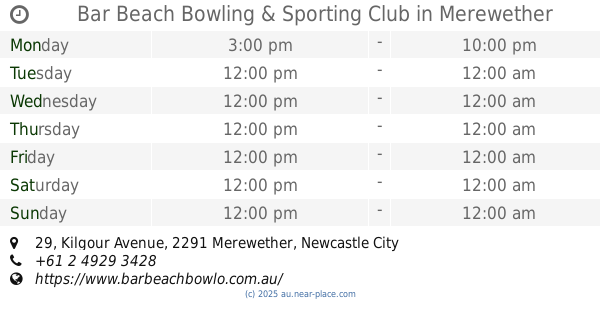
Bar Beach Bowling & Sporting Club
29 Kilgour Avenue, Merewether
Bowling alley
read more
Tenpin Bowling
326 Hillsborough Road, Warners Bay
Bowling alley
read more
Strike Bowling Charlestown
Charlestown Square, 201/30 Pearson Street, Charlestown
Bowling alley
read more
Boolaroo Bowling Club
31 Eighth Street, Speers Point
Bowling alley
read more
Strike Bowling
Charlestown Square, 201/30 Pearson Street, Charlestown
Bowling alley
read more
Tenpin Bowling Center
318 Maitland Road, Mayfield
Bowling alley
read more
Bus station
Georgetown Rd at Bowker St
Australia
Bus station
read more
Stewart Ave opp King St
Australia
Bus station
read more
Stewart Ave opp Cram St
Australia
Bus station
read more
Union St at Kemp St
Australia
Bus station
read more
St Joseph's Primary School, Union St
Australia
Bus station
read more
Carnley Ave at Carisbrooke Ave
Australia
Bus station
read more
Bingle St after Anzac Pde
Australia
Bus station
read more
Grinsell St at Kotara Pl
Australia
Bus station
read more
Stockland Glendale, Access Rd, Stand 1
Australia
Bus station
read more
Croudace Rd after Lake Rd
Australia
Bus station
read more
Parry St opp TAFE Hunter
Australia
Bus station
read more
Tyrrell St after Perkins St
Australia
Bus station
read more
Maitland Rd opp Beaumont St
Australia
Bus station
read more
Park Ave before Joslin St
Australia
Bus station
read more
King St at National Park St
Australia
Bus station
read more
Department store
Target Charlestown
Pearson Street, Charlestown
Department store
read more
Cue Charlestown Myer
Myer, Level 2, Charlestown Square Pearson Street Charlestown NSW AU 2290, Pearson Street, Charlestown
Department store
read more
Harvey Norman Bennetts Green
7 Abdon Close, Bennetts Green
Department store
read more
Kmart
Waratah Village, 91-111 Turton Road, Waratah
Department store
read more
The Reject Shop Belmont
570 Pacific Highway, Belmont
Department store
read more
Harvey Norman
7 Abdon Close, Bennetts Green
Department store
read more
BIG W Mt Hutton
Wilson Road, Mount Hutton
Department store
read more
Kmart
Northcott Drive, Kotara
Department store
read more
The Reject Shop Glendale
Shop 41, Stockland Glendale, 387 Lake Road, Glendale
Department store
read more
Cue
Myer Charlestown, 2, Chapman Street, Charlestown
Department store
read more
The Reject Shop Mt Hutton
Shops 20-22, Lake Macquarie Fair, 46 Wilsons Road, 46 Wilsons Road, Mount Hutton
Department store
read more
Kmart Glendale
10 Stockland Drive, Glendale
Department store
read more
Kmart
10 Stockland Drive, Glendale
Department store
read more
Veronika Maine Charlestown Myer
Charlestown Square, 2, 30 Pearson Street, Charlestown
Department store
read more
Myer Charlestown
Chapman Street, Charlestown
Department store
read more
📑
Newcastle all categories
Accounting
Administrative area level 2
Airport
Amusement park
Aquarium
Art gallery
Atm
Bakery
Bank
Bar
Beauty salon
Bicycle store
Book store
Bowling alley
Bus station
Cafe
Campground
Car dealer
Car rental
Car repair
Car wash
Cemetery
Church
Clothing store
Colloquial area
Convenience store
Courthouse
Dentist
Department store
Doctor
Electrician
Electronics store
Embassy
Finance
Fire station
Florist
Food
Funeral home
Furniture store
Gas station
General contractor
Grocery or supermarket
Gym
Hair care
Hardware store
Health
Home goods store
Hospital
Insurance agency
Jewelry store
Laundry
Lawyer
Library
Liquor store
Local government office
Locality
Locksmith
Lodging
Meal delivery
Meal takeaway
Mosque
Movie rental
Movie theater
Moving company
Museum
Natural feature
Night club
Painter
Park
Parking
Pet store
Pharmacy
Physiotherapist
Place of worship
Plumber
Point of interest
Police
Post office
Premise
Real estate agency
Restaurant
Roofing contractor
Route
Rv park, camping
School
Shoe store
Shopping mall
Spa
Stadium
Storage
Store
Supermarket
Synagogue
Train station
Transit station
Travel agency
University
Veterinary care
Zoo
↑